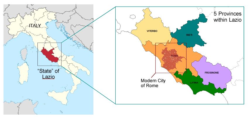
Location and Layout of Modern Rome
Rome is the largest city in Italy, both in size (approximately 500 square miles) and population (approximately 3 million). It is located in central Italy in the region of Lazio (similar to a US state) and in the province of Rome (similar US counties). Rome enjoys a temperate Mediterranean climate - it can snow in Rome in the winter, but is usually only a dusting and short lived.
The city is administratively divided into 19 districts with the historic center at its core. While existing ONLY as the historic core surrounded by city walls (shown in orange below) for 90% of its existence, today the old city covers only about 4% of today's Rome. The Tevere River (Tiber, in English) cuts through the center of the city, emptying into the Mediterranean Sea. Rolling hills are located to the east and north west, though none more than 400' in height. (Morrasut, 2008)
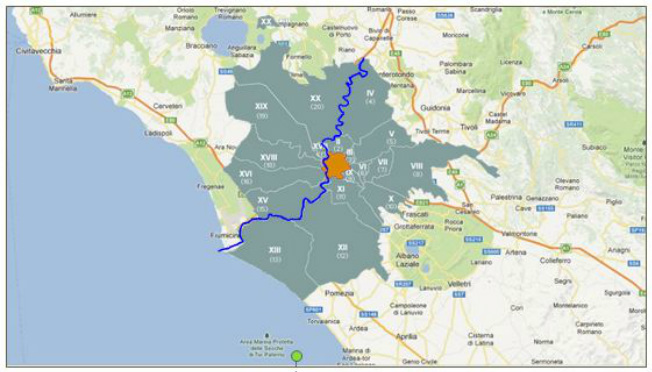
Modern day Rome divided into districts with historic center shown in orange.
(Source: Google maps & http://www.comune.roma.it)
.
